
In June last year, the Geospatial Commission published the UK Geospatial Strategy, which includes a commitment to ‘assess how location data can support the future of mobility and next-generation transport networks.’ Today, I’d like to provide an update on the Geospatial Commission’s work to promote and explore the value of geospatial data, products and services in support of the future of mobility.
Transport Location Data Taskforce
Towards the end of last year, I set out my intention to convene and chair a new ‘Transport Location Data Taskforce’ to help the Commission develop and deliver policy with respect to 6 high-level transport use cases:
- Electric vehicles, especially to support the planning and building of new EV charge points, and routing applications for electric vehicles to minimise battery consumption.
- Connected and autonomous vehicles, especially to support the provision of high-definition geospatial data to enable CAV geopositioning and routing, and the development and validation of onboard vehicle sensors.
- Roads and roadside infrastructure, especially to support the planning and construction of new roads, maintenance of existing roads, and smarter traffic management.
- Road and rail haulage, especially to support fleet telematics and management systems, freight network mapping, and optimising last-mile logistics.
- Drones, especially to support drone flight path planning, navigation, and airspace management.
- Route optimisation, especially to support strategic and operational route planning and optimisation tools.
I have so far chaired 5 roundtables with government and industry, with a further 2 planned over the coming months. Over the course of this engagement, we have identified many of the fundamental data issues we find across the other 8 geospatial opportunity areas alongside transport, as set out in the UK Geospatial Strategy, such as infrastructure and housing. The focused roundtable discussions help us narrow down to the key challenges and priorities for the future of mobility. Some of these findings include:
Data findability and accessibility:
A huge amount of geospatial data exists and is constantly being generated by a wide array of public and private sector actors, however, this data is often difficult to get hold of, or is not in a form that can be used without a lot of specialist effort. Although the Ordnance Survey, for instance, produces highly detailed geospatial datasets with wide transport applicability, a huge amount of potentially valuable data is collected by DfT and its sponsor agencies, as well as by Local Authorities - data that is often not easily findable or accessible. Even where it is findable and accessible, a lack of awareness as to how and for what purposes that data could be used for, can act as a further barrier to full utilisation.
Interoperability:
For multiple organisations and systems to utilise the same data, technical standards and effective implementation of those standards is critical. However, the world of data standards is complex, especially when engaging sectors. The existence of standards does not guarantee adoption or use; the main challenge for stakeholders is efficiently applying standards in a way that is beneficial to both the wider stakeholder group and end-user. For example, challenges of integrating fleet telematics data across multiple logistics providers using different routing systems and generating time-stamped location data at different intervals was highlighted at one of the roundtables. Standardising such data could help support better logistics analysis to optimise operations involving multiple operators, such as at a busy port. Interoperability is further complicated by changing technologies and new ways of working meaning standards need to be adaptable.
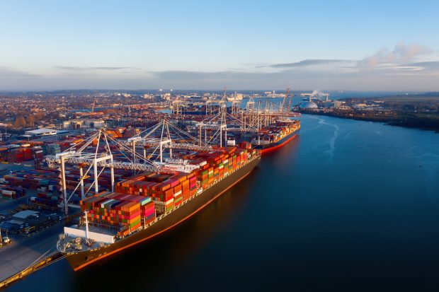
Image Credit: Anita van den Broek, Shutterstock
Data quality:
For data that does exist, there is often a huge variation in the quality of that data. This seems especially true for data held by Local Authorities. While the data might be fit for purpose from an organisational perspective, for third parties aggregating, integrating, and reusing such data from multiple sources and at varying quality levels to deliver new services or insights, it can prove to be a complex and challenging process. At one roundtable we discussed the different approaches to supporting data improvements from providing funding to imposing regulatory obligations on better data management and quality assurance processes.
New technologies:
In addition, contemporary technologies are revolutionising the way we think and talk about geospatial data beyond physical or digital maps. APIs, photogrammetry, mobile phones and apps, vehicle telematics systems, and remote IoT sensors are just some examples of new sources of geospatial information that could be critical in creating whole-system, dynamic, and real-time views of the transport ecosystem.
The most important outcome of this work will be the identification of specific issues where overcoming challenges in specific use cases can make a significant difference for the future of mobility. As we approach the end of our initial engagement phase, I look forward to working with members of our Transport Location Data Taskforce and other government departments in shaping our future transport projects and recommendations to unblock these challenges and unlock the power of location.
Transport innovation competition
Alongside our roundtables and policy work aiming to identify the fundamental data fixes needed to unlock key future mobility use cases, we are also supporting market-led innovation to address existing challenges and exploit future opportunities. Through our £2million Transport Location Data Competition partnering with InnovateUK and utilising the Small Business Research Initiative (SBRI), we are taking practical steps to foster innovative geospatial initiatives for current and future transport challenges across four key areas:
- Promoting active travel
- Enabling mobility as a service
- Managing supply chains
- Increasing capacity.
We received nearly 200 applications, and in January, announced the 28 winners who are now working hard to deliver solutions through feasibility studies to address the key challenges by March of this year.
Over the coming weeks, we’ll be inviting project leads from a few of these organisations to discuss more about their projects and showcase their work on our blog.
Get involved
We are always eager to hear about ideas, case studies, insights, and research to help support and shape the future of our transport programme. To get involved, comment below or email us at geospatialcommission@cabinetoffice.gov.uk.