
Unlocking the value of geospatial technology requires developing more people with the right skills to work with location data, across organisations and sectors, to meet the UK’s future needs and support global development.
The Geospatial Commission is collaborating with a wide range of organisations to support employers to understand their geospatial skill requirements and for employees to know how to acquire and develop geospatial skills across all stages of their career. Apprenticeships are a key entry point option in geospatial career pathways.
To celebrate National Apprenticeship Week, 8 - 14 February, the Geospatial Commission invited views on geospatial apprenticeships from:
- Paul Bryan, Geospatial Survey Manager at Historic England and apprentice manager
- Elizabeth Stephens, Geospatial Survey Technician Apprentice at Historic England
- Mark Combes, Non-Executive Director at the Severn Partnership, a firm of Chartered Land surveyors that provide surveying, mobile mapping, subsurface mapping, 3D modelling, laser scanning, building information modelling and visualisation services for infrastructure.
- Luke Blakemore, Surveyor and Geospatial Surveying & Mapping Sciences apprentice at Severn partnership.

Paul, what is a geospatial apprenticeship?
For many years apprenticeships have provided an opportunity for starting a career whilst receiving on-the-job training, gaining experience and getting paid to undertake it. Following the UK government introduction of the Trailblazer Apprenticeship initiative in 2017, RICS, Chartered Institution of Civil Engineering Surveyors (CICES) and The Survey Association (TSA), along with representatives from the wider geospatial industry, established the Geospatial Apprenticeships Trailblazer Group to develop specific geomatics sector apprenticeship proposals.
Following cross-industry discussion by the group, including later participation by Historic England, two standards were formally approved for delivery in 2018 by the UK governments Institute for Apprenticeships (IfA):
- A two year, Level 3 Geospatial Survey Technician apprenticeship focused on the collection, processing and presentation of geospatial data.
- A five year, Level 6 Geospatial Mapping and Science Specialist Apprenticeship (Degree) Apprenticeship based on interpreting, manipulating and analysing geospatial information.
Both combine on-site work with off-site study by mixing 80% on the job training provided by the employer with 20% classroom learning on a range of related topics supplied by an external training provider.
Lizzie, what made you apply to your apprenticeship at Historic England?
I did a degree at Lincoln University, in conservation and restoration of historic objects. I then spent a year abroad teaching in Thailand. When I came back to the UK, I struggled to find work in conservation and for the past few years, I’ve had a number of retail jobs in hospitality. I was desperate to get back into heritage. When I saw this apprenticeship, it sounded perfect. It was a great way to build a career in the area I’m passionate about.
Paul, why do we need geospatial apprenticeships?
Back in 1982, when I became a surveyor, the traditional route into our profession involved studying surveying and/or a related subject at university level before graduating and applying for a junior surveyor position within one of the commercial survey companies. Nearly 40 years on that route is still seen by many as the only way into a surveying career. However, for those that are unsure about going to university, want a career change or to further develop a specific skill area, apprenticeships provide another option for attracting new people and new skills into the geospatial sector by allowing them to be paid whilst they learn.
As the technologies we use, such as laser scanning and ‘Structure-from-Motion’ photogrammetry, and the processes we apply, such as Building Information Modelling (BIM), continue to develop, the industry must maximise the opportunities they present. This is where an apprenticeship route, focused on developing the next generation by bringing in new talent that’s better able to adapt to such rapid technological change, has a very important part to play.
Apprenticeships also provide an important means for an ageing surveyor such as me, that is nearing retirement in June this year, to pass on some of the knowledge, skills and expertise I have managed to accumulate during my own surveying career. Yes, I now undertake teaching, publish guidance, talk at conferences and most recently present on webinars but there is no better way to teach surveying to someone else than by undertaking it alongside them.
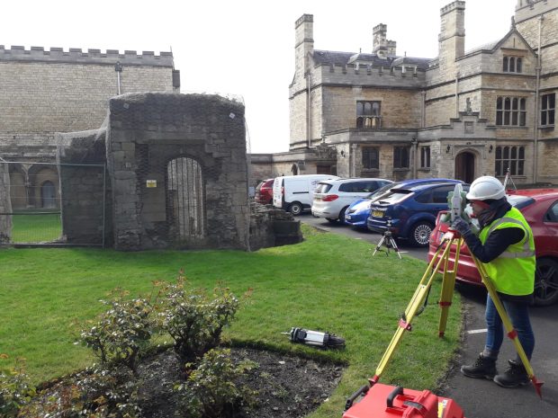
Lizzie, can you describe a typical day as an apprentice at Historic England?
A typical day is hard to describe. I’ve been out of the office so much on-site visits. I’ve been to caves, museum stores, looking at either whole buildings or tiny coins. There is such a diverse range of projects. When I’m actually in the office, I’m mainly processing photos that we’ve taken on-site, and trying to get my head around some of the software, and often attending meetings about upcoming projects.
Paul, what do apprentices bring to Historic England?
At Historic England, apprenticeships are greatly valued which is why we’re leading on the development of new apprenticeship routes into the heritage sector, supported by several other heritage organisations. We want to support individuals who are passionate about contributing to the care of our spectacular historic environment, in turn contributing to future-proofing the skills needed for the sector and our own organisation. The Geospatial Survey Technician Apprenticeship was the organisation’s first specialist apprentice recruitment in 2018 enabling it to learn from the experience and feed into other areas being developed, such as our Historic Environment Advice Assistant (HEAA) apprenticeships. The number and range of apprenticeships we now offer continues to grow and it is hoped we can continue to take advantage of geospatial apprenticeships as opportunities arise.
Luke, how has an apprenticeship supported your development?

Not only do I learn about Geospatial theory, but one of my current modules ‘Business Management and Professional Studies’ allows for a greater insight into the management side of the construction industry, important for my career advancement. Whilst on the course I have gained promotion to Senior Surveyor and currently manage some of the larger mapping projects using the latest Pegasus: Two Leica Geosystems technology, which has taken me to some great locations, here and abroad.
Mark, why are apprentices important to Severn Partnership?
As a previous president of The Survey Association (TSA) board, geospatial apprenticeships are a great career path into a dynamic, varied industry. Severn Partnership’s apprentices have quickly become an integral part of the business, helping increase productivity in the workplace. We have been able to free up time for more senior colleagues to work at a higher level, as capability and trust has grown amongst the team.
The Geospatial Apprenticeship scheme has enabled Severn Partnership Ltd to meet the future needs of our clients as they embrace the digital revolution. We are preparing for the future now by building a more capable workforce, whilst offering opportunities to people who may not otherwise have a gateway to such a fantastic industry.
Lizzie, final word for you - what has been the highlight of your apprenticeship so far?
It was the first site I went on, which was only in my second week. It was two caves in Nottingham – I never knew there were masses of caves under Nottingham! The ones we visited that day were all under pubs. We’d walk into a pub and then down into the cellars and then carry on going down. The scanning equipment we were using gave us an instant 3D image as we were walking around. It was a really important moment for me, right at the beginning of my apprenticeship, to see it all coming together and was a great introduction to the geospatial side of heritage.
I’ve also been to Longthorpe Tower, just on the outskirts of Peterborough. That was really beautiful because it’s full of medieval paintings. Another highlight was Dunston Staithes in Gateshead; it is a huge wooden structure and was completely different to anything else I’ve worked on.
The Geospatial Commission would like to thank both, Paul and Mark, for their thoughts during National Apprenticeship Week and wish their geospatial apprentices luck!
Sign up to this blog to get an email notification every time we publish a new blog post.