Jamie Clark, Deputy Director, Geospatial Commission

Global Britain leading the geospatial way
Posted by: , Posted on: - Categories: Data, Technology

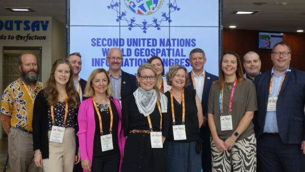
In 2021 the government set an aim to secure the UK’s status as a science and technology superpower. The UK’s geospatial community is doing its bit with a successful trip to the UN World Geospatial Information Congress and external recognition as the UK retained its position as second in the world for geospatial capability.

The Public Sector Geospatial Agreement - one year on

Posted by: , Posted on: - Categories: Data, Technology
Cupcake wth one sparkler on a blue background

Jamie Clark, Deputy Director (Commercial) at the Geospatial Commission, provides an overview of how the Public Sector Geospatial Agreement (PSGA), that has been in place between the Geospatial Commission (GC) and Ordnance Survey (OS) since April 2020, has been delivering …

How geospatial data is supporting the UK’s response to the coronavirus pandemic

Posted by: , Posted on: - Categories: Data, Technology
Red location icon on a rock overlooking a act at sunfall

Coronavirus and geospatial data Geospatial data has been used to identify causes of disease, track its spread and monitor the recovery of patients since the 19th century, when John Snow mapped cholera outbreaks in London in 1854.  Image: Snow, J. …