Construction Playbook refresh to improve the re-use and accessibility of ground investigation data. This refresh now makes it a requirement that ground investigation data collected must be shared as soon as reasonably possible with the British Geological Survey as a condition of the contract.
Yesterday the Crown Commercial Service (CCS) opened the Space-Enabled and Geospatial Dynamic Purchasing System (DPS) to buyers right across the public sector. The new DPS will make it easier for the public sector to procure access to a broad range …
By looking at licensing from the user perspective the Geospatial Commission and Geo6 have worked together to make data licensing and data more accessible.
Guest blog by Carl Watson, Senior Analyst and UX Lead, British Geological Survey who shares the steps taken to build a data portal for the user. “After listening to what real users want we have created guidelines for Designing Geospatial …
Guest blog: Howard Askew shares the benefits of the latest Data Improvement tool - List of Geospatial Data Publishers by theme or topic, and how it tackles two of the big challenges faced by users of geospatial data today.
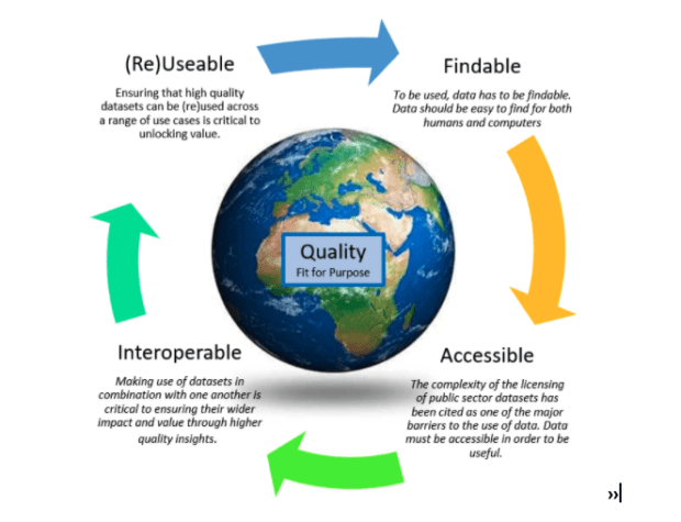
Callum Irving, Senior Data and Standards Advisor, shares the Geospatial Commission’s ambitions to improve access to better location data by making it Q-FAIR - Findable, Accessible, Interoperable, Reusable and of the right Quality that is fit for purpose. Building on …
As Data Standards Lead at the Geospatial Commission I have been investigating species data and the path it takes from getting collected to being made available, to monitor species. Knowing a species geographic location is fundamental to many aspects of biodiversity conservation.