Isabella McGuinness, Senior Policy Advisor, shares her experience attending the UN Committee of Experts on Global Geospatial Information Management (UN-GGIM).
The United Nation’s Committee of Experts on Global Geospatial Information Management (UN-GGIM) operates under a formal mandate from the United Nations (UN) Economic and Social Council. UN-GGIM's mission is to make accurate, reliable and authoritative geospatial information readily available to support national, regional and global developments.
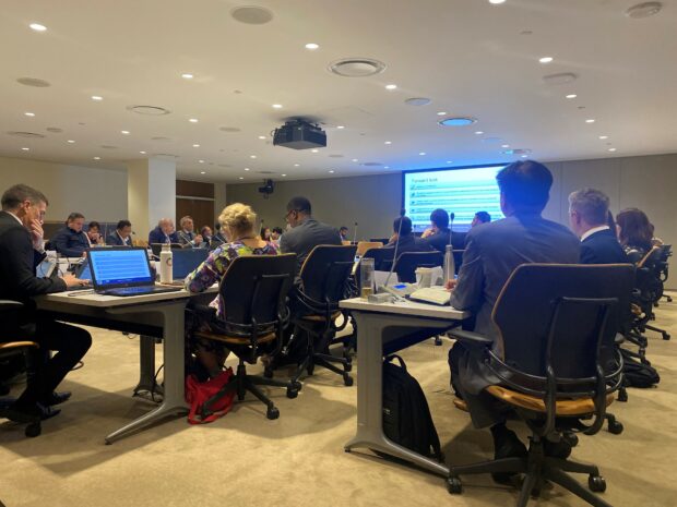
The Fourteenth Session of UN-GGIM took place from 5th to 9th of August, at the UN Headquarters in New York. I was looking forward to a week of fruitful discussions which started with a series of side events and finished with the formal 14th session which saw 75 Member States discussing and agreeing the meeting agenda items.
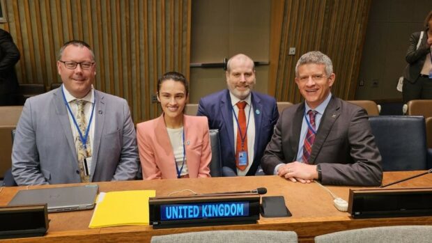
The UK has played an active role within UN-GGIM from its original concept through to its growth and development into the leading forum to discuss geospatial information on a global stage. The UK delegation was made up of representatives from Ordnance Survey and the Geospatial Commission and the meeting offered an opportunity for the UK to demonstrate geospatial leadership and capability. Ordnance Survey acts as the Secretariat for the UK Delegation, leads and coordinates UK involvement, and acts as Head of UK Delegation during the Committee of Expert meetings on behalf of the Geospatial Commission.
The side events at the start of the week included the meeting of the High-level Group for their Fourth Plenary meeting. The High-level Group leads the Committee of Experts work on the UN Integrated Geospatial Information Framework (UN-IGIF) and provides strategic guidance which enables countries to prepare and implement geospatial action plans.
Onto the formal 14th session, there were a lot of discussions and sharing of knowledge and experiences amongst the Member States.
Over the three days, the UK delegation made four interventions on the following topics:
- Agenda Item 3: Enhancing Geospatial Information Management
- Agenda Item 6: The Future Geospatial Information Ecosystem
- Agenda Item 7: United Nations Integrated Geospatial Information Framework
- Agenda Item 10: Geospatial Information for Climate Resilience
Highlights:
- Collaboration: A key theme I took from the week is that there is a need for collaboration within our ecosystem. During the Plenary meeting of the UN-IGIF, I heard updates on activity over the past year and a forward look from the three IGIF working groups: The Sustainable Funding Working Group, the Capacity Development Working Group and the Communications Working Group (which the UK co-chairs and provides secretariat resource to). For me, a key takeaway from this meeting was the need for collaboration between the Working Groups within the High-level Group. The updates from each Working Group demonstrated that there are lots of opportunities to work together to achieve shared goals and avoid duplication of efforts.
- Making connections: I enjoyed creating new and strengthening existing connections throughout the week. A moment that sticks out for me was meeting the IGIF Communications Working Group in person for the first time after many virtual meetings together.
- Knowledge sharing: Attending the 14th Session was a great opportunity for me to learn from other countries. During the High-level Group meeting, it was great to hear from three regions who presented case studies of the use of the UN-IGIF. As a part of the UK’s role on co-chairing the Communications Working group, we are keen to collect case studies of regions experiences using the UN-IGIF and the benefits and challenges. It was great to hear these experiences and think how we can use these case studies in future work.
- Delivering an intervention on behalf of the UK: Another highlight of mine was delivering an intervention on behalf of the UK delegation on the UN-IGIF with a focus on being collaborative and outcome orientated as well acknowledging the work that has been progressed by the High-level Group Working Groups over the past year.
UN-GGIM is a globally important forum to enable countries to work together as a collective to promote all things geospatial and share knowledge. It is also an opportunity to create and strengthen connections with others which as I mentioned earlier, was one of my highlights. A key thing I took from the week is that there is a need for collaboration within our ecosystem.
On behalf of the UK delegation, I would like to thank the UN-GGIM Secretariat, Bureau, Co-Chairs and all Member States for a successful 14th session and I look forward to contributing to future deliverables.
For more information on the UN-GGIM 14th session, please visit the UN-GGIM website.
You can also sign up to get an email notification every time we publish a new blog post. For more information about this and other news see our website, or follow us on LinkedIn and X (formerly Twitter).